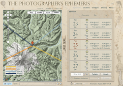
 Planning just the right time and location for landscape photography can be challenging. Landscape photographers typically want to plan their shoots around the times of sunrise/sunset or twilight.
That’s why photographer Stephen Trainor created the Photographer’s Ephemeris, an Adobe AIR application that provides a visual and simplified solution for finding vantage points for dusk and sunset photography. It integrates satellite and terrain maps from Google into a visually pleasing interface.
Link: The Photographer’s Ephemeris App
Read on for a couple video tutorials showing this tool in action.


